|
|
|
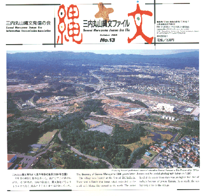
三内丸山縄文時代から五千年後の風景(1994年空撮)八甲田の裾野に集落はあった。南にはブナの森が広がり、 北に陸奥湾。当時の海面は、縄文海進で今よりも5mほど 高く、集落のすぐ近くまで海が迫っていた。 |
The Scenery of Sannai Maruyama 5000 years later Jomon era (An aerial photograph taken in 1994)The village was located at the foot of Mt.Hakkoda. There was a Beech tree forest which extended to the south with Mutsu Bay spread to the north. The water level of the sea in those days was 5m higher than that of today's because of Jomon Kaishin. As a result, the sea lay very close to the village. |