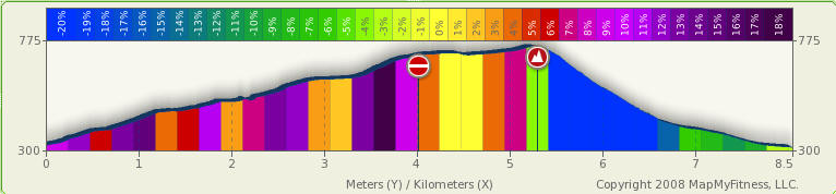
Takamizu-Iwatakeishi 「高水山-岩茸石山」 MTB circuit (8.5km, 450m climb, 1hr30)
Category: Road: 1.3km, Dirt: 4.5km, Hike trail: 2.7km
Route: Nariki, Takamizu dirt road,
Takamizu-san, Iwatakeishi yama, Nariki
Map:
Profile:
Notes:
.
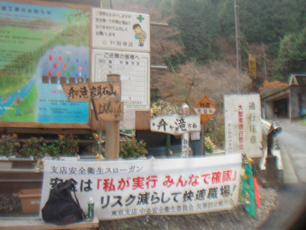
The dirt road starts just after the soba restaurant below Kosawa-toge Tokyo side.
The surface is excellent but the last 200m before the toilets is very steep
(about 15%).
Onishi-san of KFC triatholon
(http://www.gem.hi-ho.ne.jp/kfc-onishi/) used to hold an mtb race up this
route to Mt Takamizu starting from the Soba restaurant (the same starting point
as the Nariki Hill climb) taking about 30mins for me to the goal.
The hiking trail section from Takamizu to Iwatakeishi yama is a popular trail for
hikers, so try not to
schedule for a Sat/Sun morning/afternoon unless you get out very early. 12pm is
a pretty busy time at the top of both peaks. It's not so far though, so you
could just walk this section in about 30mins.
You will need to carry your bike up and down the last 100m of Iwatakeishi - this
is the toughest section.
The
trail down to Nariki from Iwatakeishi is not crowded. You
should be able to cycle 80% of the trail and will need to carry your bike over
some of the sections. See photos to get better idea of trail surface
The Ome city map I have (Shobunsha 1995) shows the dirt road continuing on
past the temple/toilets near Takamizu top, and descending to Shiraiwa near Enoki-toge, but this is
a mistake - the dirt road ends at the temple. There is a trail that comes out at
Enoki-toge, but it has two very steep sections so is not suitable with a bike,
amd you need to descend back down 1.5km of the road up as well.
This trail up will be used for the
Takamizu trail run 2009
also organized by KFC.
Photos:
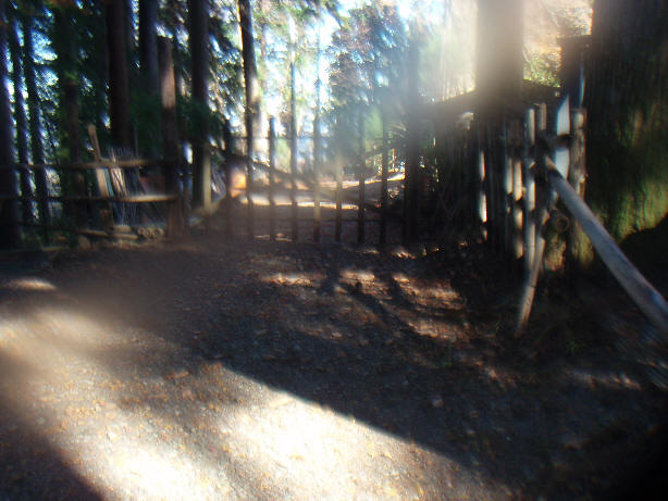
Gate at temple - you can just sneak bike around the left post
Take a long loop passing the temple to find the slope with least gradient to
the top.
Alternatively, leave your bike at the temple and walk up and down, or just skip
going to the top altogether.
Don't take the steep way down from the top as below:
Instead, follow the road immediately to the right of the toilets along the
North face of Takamizu
This route offers a much better and quieter alternative
Looking back - the North route joins from the left and the main route comes
down the shoulder.

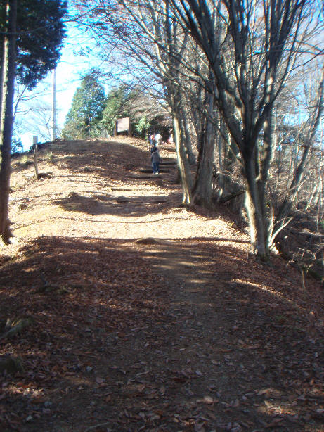
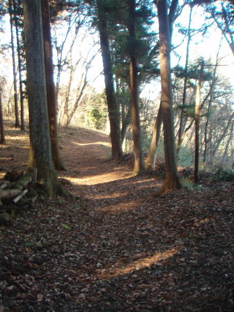
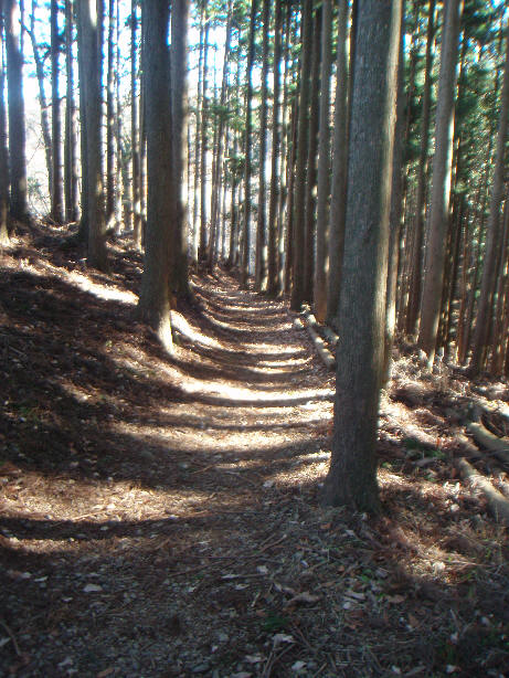
In general, the trail is very good along here. However there are some steep
sections as below:
You might even get away with cycling on weekends as the trail is quite wide
You must carry your bike up the last 100m (distance not elevation) of
Iwatakeishi yama.
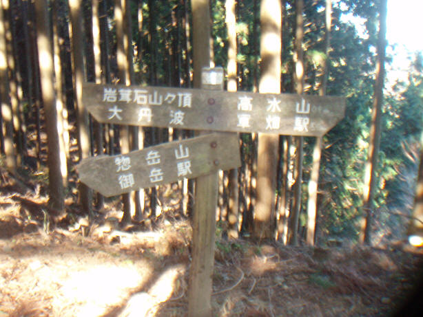
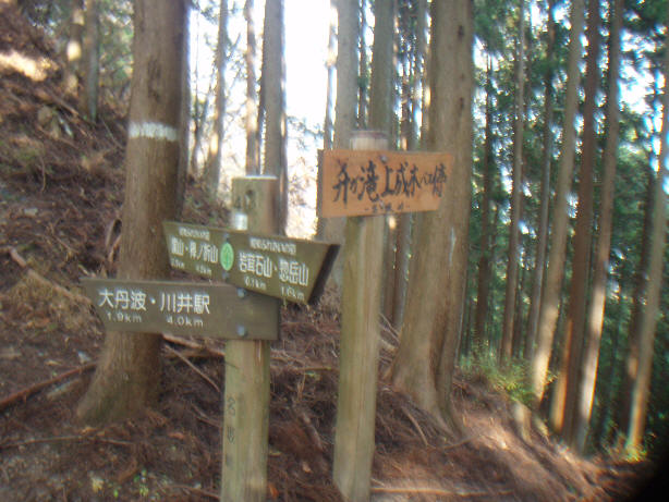
You can head straight up from this sign or cycle around to join the trail from
Mitake and climb from there.
Straight up is less dangerous but around the back is the scenic route!
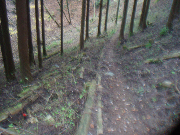
Looking down the trail after climbing straight up from the sign in above
photo:
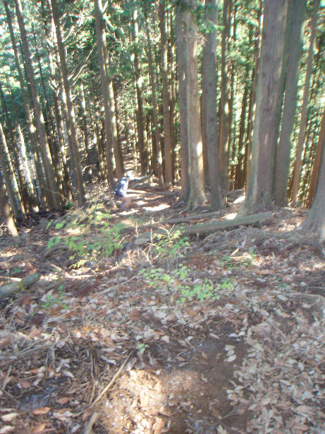
And looking up to the top from same point as in above photo:

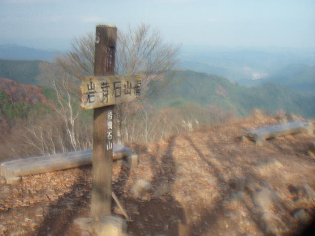
Iwatakeishi top
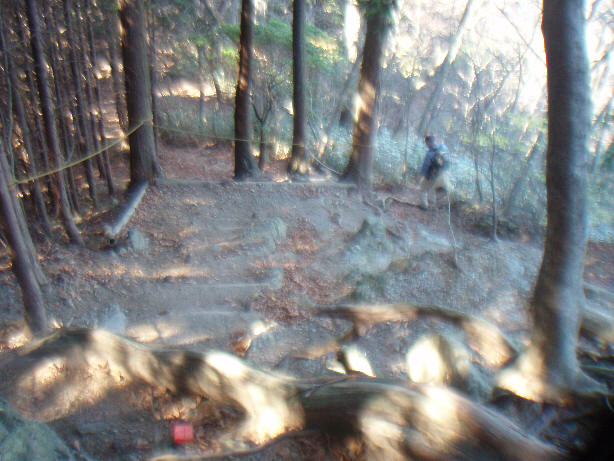
Initial 100m (distance, not elevation) descent is steep - will probably need
to carry bike
Looking back up after descending 60m
There are some steps on the steepest section
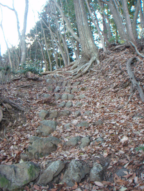
And also lack of steps as well - be careful!
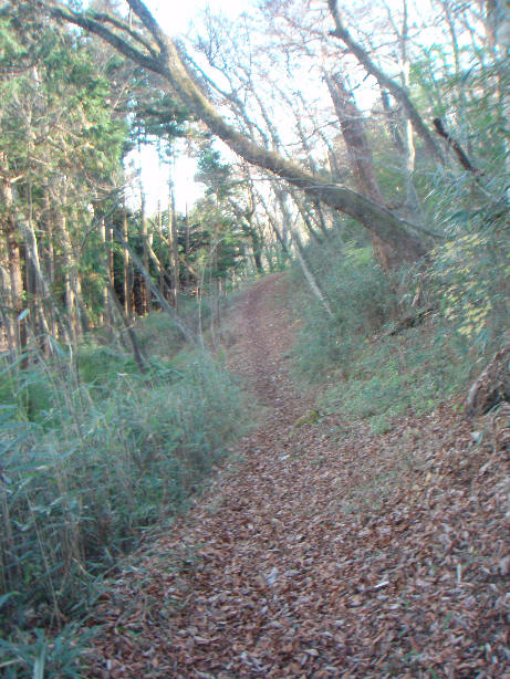
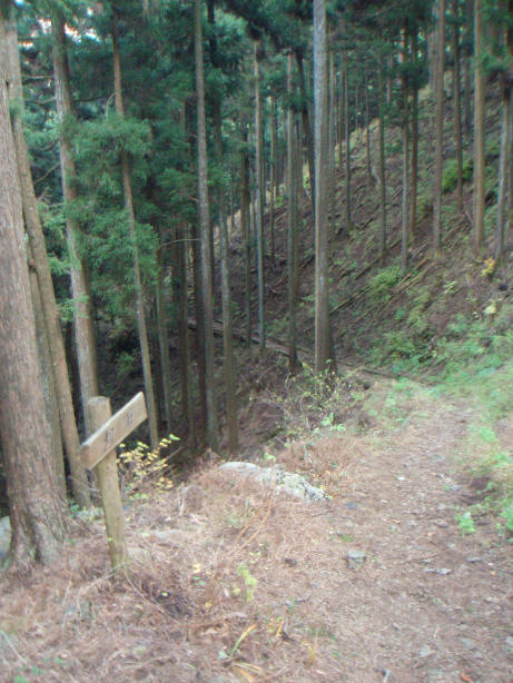
Nasaka-toge is not far. From here, follow the trail to Masugataki and Kami-Nariki bus stop
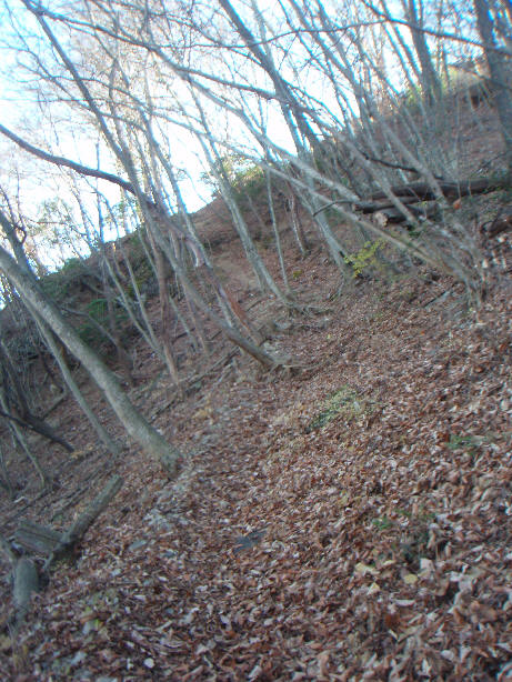
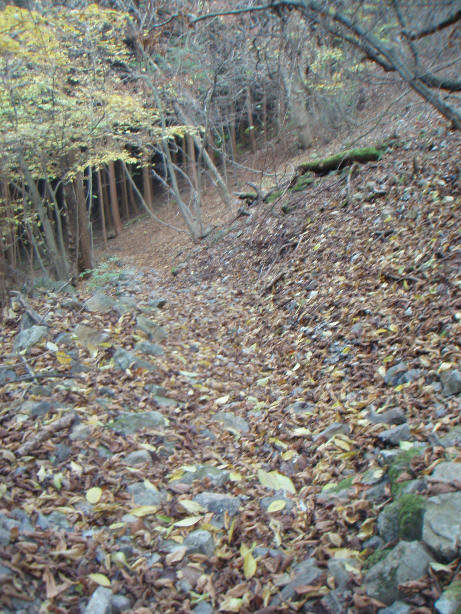
After passing the sign above, the trail is mostly good surface and not so
steep. There are some sharp switchbacks as below.
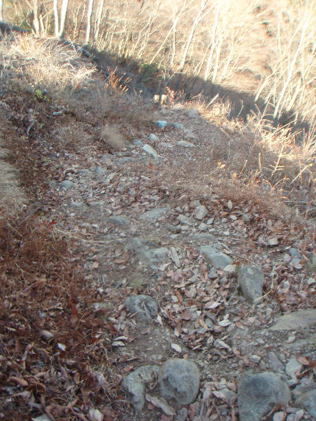
Some large stones as below in areas but only occasionally.
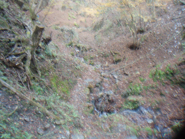
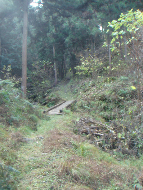
One of the steeper sections along the stream
Good wooden bridge over the stream
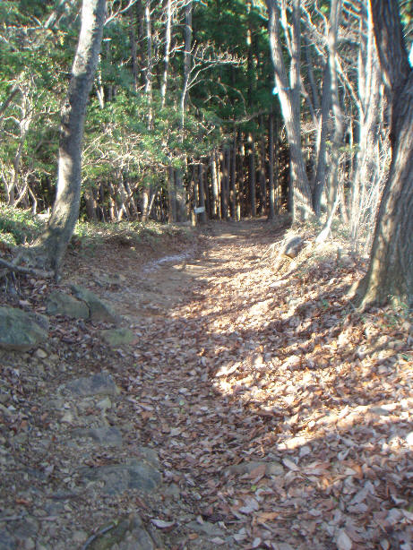
The route is well signposted - the trail is very obvious all the way down
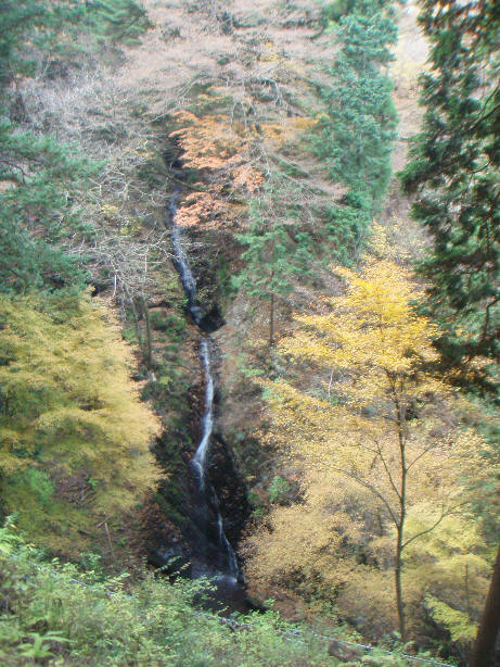
You can leave your bike at the sign for waterfall and take the 5min (1 way)
walk to the viewpoint and back.
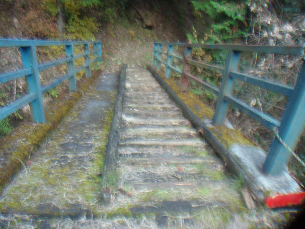
First impression - accommodation for cyclists, however it's simply a wooden
ladder on the right.
This is the entrance to the trail from the road